Shop by Category
Shop by Price
Shop by Brand
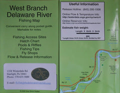
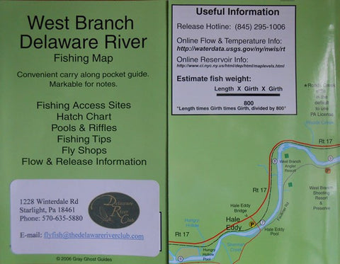
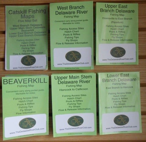
Delaware River System Individual Fishing Maps
$8.00
The Delaware River River system broken down into five individual waterproof maps. Each map covers one section of river. West Branch Delaware River, Upper Mainstem Delaware River, The Beaverkill, Lower East Branch Delaware River, and Upper East Branch Delaware River. Each map is 7" H X 18" L and printed front and back.
Map information includes:
- Fishing Access Sites
- Hatch Chart
- Pools and Riffles
- Fishing Tips Fly Shops
- Flow and Release Information
Product Images (click to enlarge)
Featured Flies - What's working RIGHT NOW!


